Free Printable Map of Australia With States – Looking for a free printable map of Australia with states? Whether you are a teacher preparing a geography lesson, a homeschool parent, a student working on a project, or simply curious about Australia’s layout, a clear outline map showing the states and territories is one of the most useful classroom and reference tools.
Australia is both a country and a continent. It is divided into six states and two mainland territories. A good printable map makes it easy to see the borders, label the regions, and learn the capital cities.
Below you will find trusted places to download free printable maps (many sized for standard US Letter paper), a quick overview of the states and territories, practical tips for printing and using the maps, and short answers to common questions.
Why a Free Printable Map of Australia With States Is Useful?
Blank or lightly labeled maps help students memorize locations without relying on a fully filled-in reference. Teachers use them for quizzes, coloring activities, and map skills practice. Travelers and hobbyists often print them to mark places they have visited or plan to see.
A useful free printable map of Australia with states typically shows:
- The six states and two mainland territories
- Clear internal borders
- The overall outline of the continent
- Optional capital city markers or labels
Most free versions come as PDF files that print cleanly on home or school printers.
Official Free Outline Map From Geoscience Australia
The most authoritative source is Geoscience Australia. Their basic outline maps are designed for classroom use and include versions with state borders.
You can download the free PDF of the outline map of Australia with state borders from the official data portal:
Outline map of Australia (with state borders) – Data.gov.au / Geoscience Australia.
These maps are simple black-and-white line drawings, ideal for labeling exercises and printing on US Letter paper.
Other Reliable Free Printable Options
Several independent sites offer high-quality free downloads that include state and territory borders, labeled versions, and print-ready PDFs sized for A4 or US Letter:
- Ultimaps Blank Map of Australia States – Free PDF (Letter and A4), PNG, and editable SVG files. Includes blank, outline, and labeled versions. Suitable for personal and educational use (attribution requested).
- Mappr Australia Blank Maps – Free printable PDFs and PNGs showing state and territory borders, labeled maps with a key, and colored versions. Straightforward downloads for classroom or home use.
- World Map Blank – Blank Map of Australia – Free blank political map with state and territory borders plus a plain outline version, available as PDF and JPEG sized for A4 and US Letter.
These resources provide clean, ready-to-print files without requiring payment or complicated sign-ups for the basic free versions. Always check the license notes on each site for commercial or redistribution rules.
Free Printable Map of Australia With States
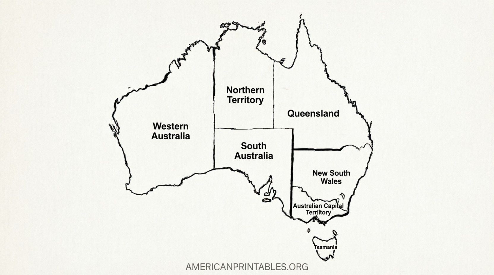
Australia’s States and Territories at a Glance
Australia has six states and two mainland self-governing territories:
| State / Territory | Capital |
|---|---|
| New South Wales | Sydney |
| Victoria | Melbourne |
| Queensland | Brisbane |
| Western Australia | Perth |
| South Australia | Adelaide |
| Tasmania | Hobart |
| Northern Territory | Darwin |
| Australian Capital Territory (ACT) | Canberra |
Canberra, in the ACT, is the national capital. Tasmania is the only island state. Western Australia is by far the largest by area. Most of the population lives along the eastern and southeastern coasts.
A free printable map of Australia with states makes these divisions easy to visualize and label.
How to Print and Use Your Map?
- Download the PDF version when available – it usually preserves sharp lines.
- Open the file and select “Fit to page” or “Actual size” in your print settings so the map fills standard US Letter paper without unwanted cropping.
- Use black-and-white printing for the cleanest results on most home printers.
- For classroom activities, print multiple copies of a blank version for students to label and a labeled version as the answer key.
Common classroom uses include labeling states and capitals, coloring regions, marking major cities or landmarks, and creating simple quizzes.
Brief FAQ
How many states does Australia have?
Six states plus two mainland territories (Northern Territory and Australian Capital Territory).
Is Canberra a state capital?
Yes – it is the capital of the Australian Capital Territory and also the national capital of Australia.
Can I use these free maps for school projects?
Yes. The official Geoscience Australia maps and the free educational versions listed above are intended for classroom and personal use. Check each site’s license if you plan commercial distribution.
Do the free maps show external territories?
Most simple printable maps focus on the mainland states and territories plus Tasmania. External territories such as Norfolk Island or Christmas Island are usually omitted at this scale.
A free printable map of Australia with states is a straightforward, practical resource. Start with the official Geoscience Australia outline for the most authoritative version, then explore the other free PDF options if you need labeled or higher-resolution files. Print a few copies, grab some markers or colored pencils, and you are ready to explore Australia’s geography.