Printable World Map for Kids – Free PDF Downloads – A printable world map for kids is one of the simplest tools you can use to teach geography at home or in a U.S. classroom. Kids can color continents, label oceans, mark places they have visited, and start seeing how North America fits into the rest of the planet.
This page explains what to look for, how to print a map on standard U.S. Letter paper, and where to download legitimate free files. Every external link below goes to the actual download or official resource page.
What a Kids’ World Map Should Include?
A good world map for children is easier to read than an adult reference map. The best versions keep labels large, use clear continent shapes, and avoid crowding every border and capital onto one sheet.
Most elementary maps in U.S. schools focus on:
- The seven continents: Africa, Antarctica, Asia, Australia/Oceania, Europe, North America, and South America
- The five oceans: Arctic, Atlantic, Indian, Pacific, and Southern
- Simple country outlines for older elementary and middle school students
- Space to color, write, or add stickers
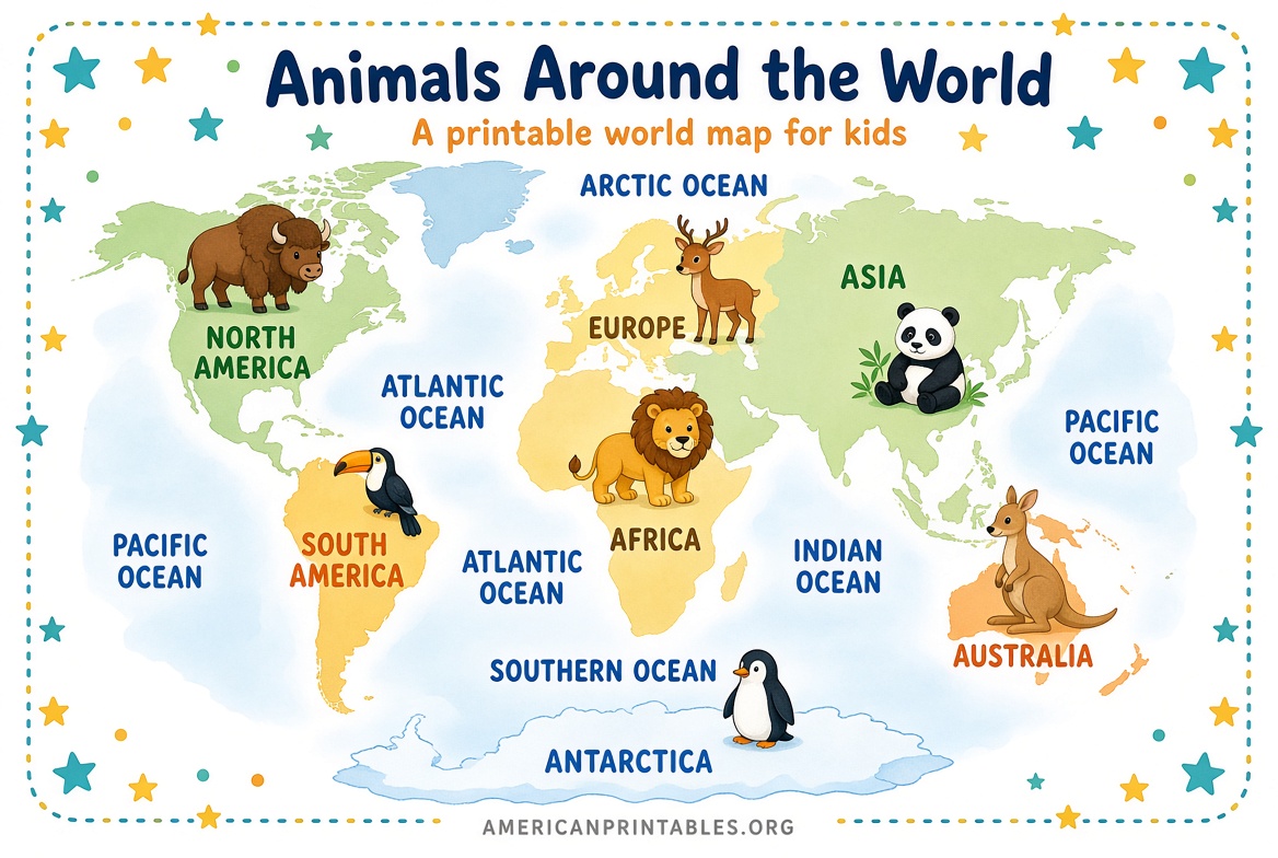
Younger kids often learn faster with pictures—animals, landmarks, or flags—than with a dense political map.
Which Printable World Map to Choose?
Pick the map that matches the child’s age and the lesson, not the most detailed file you can find.
Preschool to Grade 1
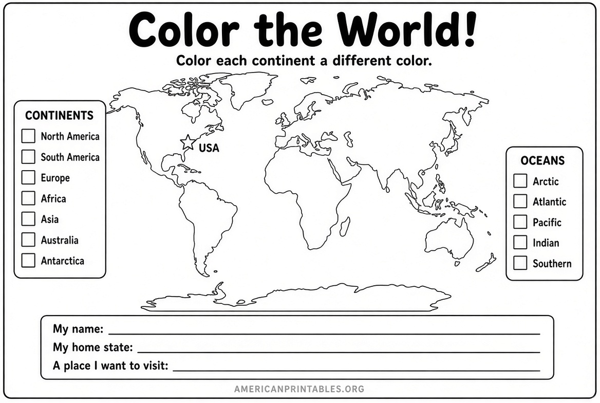
Use a picture or coloring map. Continents should be easy to tell apart. Labels can wait.
Grades 2–4
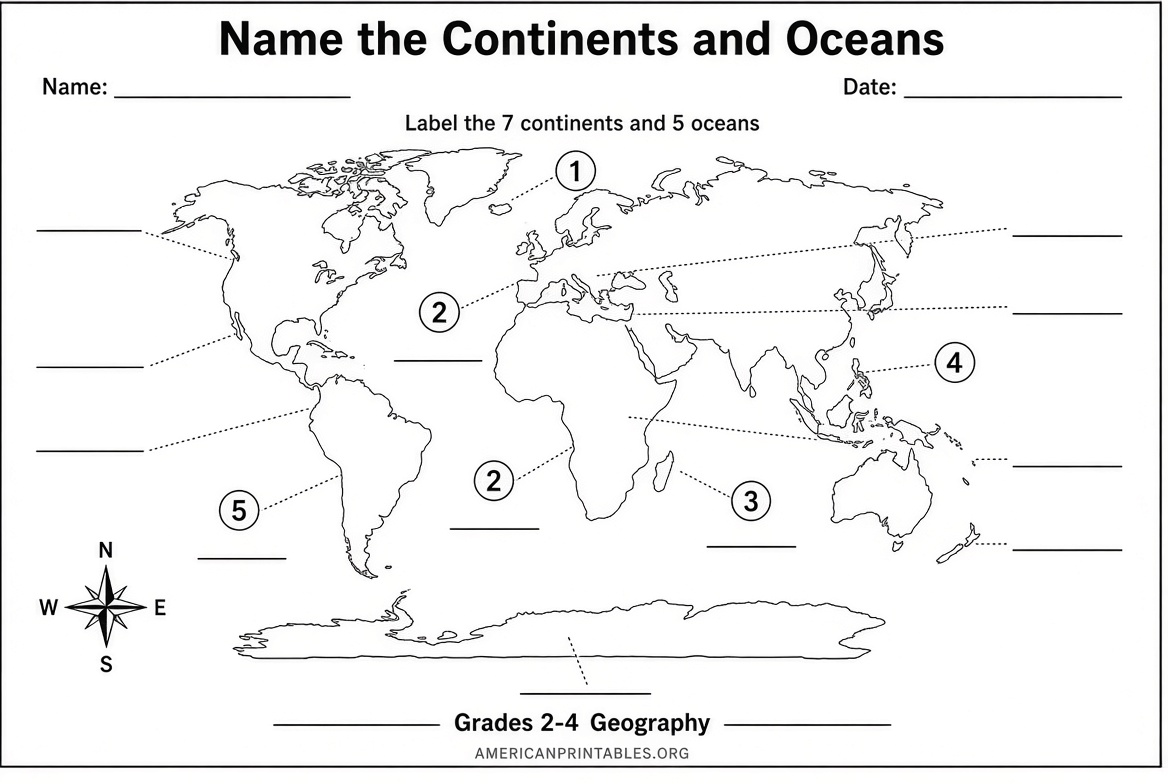
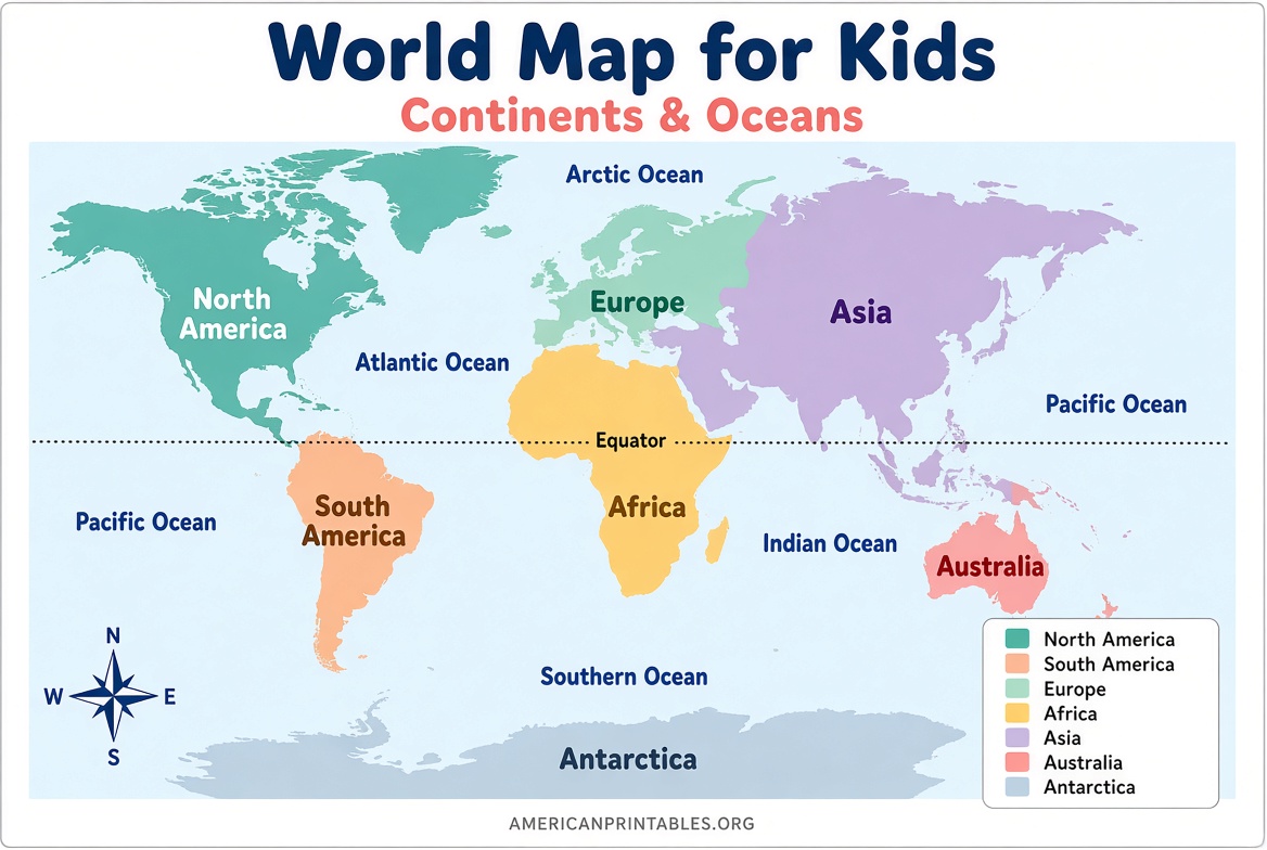
Use a labeled continents-and-oceans map, plus a blank version for practice. This is the stage when many U.S. students first memorize continent and ocean names.
Grades 5–8
Use a labeled political world map and a blank outline map. Students can find countries, compare sizes, and talk about hemispheres, the Equator, and the Prime Meridian.
Family wall project
Use a larger coloring map you can tape together. It takes more time, but it becomes a display kids keep adding to.
Where to Get a Free Printable World Map for Kids?
These five sources are current, widely used, and offer real free files. Read the notes before you download so you know whether you need one sheet, several pages, or an email form.
1. National Geographic coloring map with flags
National Geographic adapted its World for Kids cartography into a free coloring map. The PDF is nine pages: eight map panels plus a flag-color key. When you trim and tape the panels, you get a 36-by-24-inch poster kids can color by country.
This is a project map, not a quick homework sheet. It works well for a weekend activity or a classroom wall. No account is required on the article page.
Download it from National Geographic’s official coloring-map page:
National Geographic free world coloring map
2. World Map for Kids (animal, picture, and country versions)
If you want a single-sheet printable world map for kids that fits U.S. Letter paper, this is one of the most direct options. The free set includes three different maps:
- An animal map with named continents and oceans
- A picture map with landmarks and no labels, good for coloring
- A country map colored by continent for older kids
Files are offered as PDF and JPEG, with no sign-up required for the free versions.
Get the kids’ maps here:
Free world map for kids (PDF and JPEG)
3. We Are Teachers classroom map bundle
This U.S. education site offers a free printable world map bundle made for teachers. It includes Mercator and Robinson projection maps, a blank Robinson map, a labeled political map that prints across two pages, and worksheets such as a country scavenger hunt and a cut-and-paste labeling activity.
The maps are free, but you fill out a form on the page to receive the files. That is useful if you want ready-made lesson sheets instead of a map alone.
Request the bundle here:
We Are Teachers free printable world map bundle
4. CIA World Factbook political map (public domain)
For a labeled political reference map, U.S. government maps are a reliable choice. The 2023 CIA World Political Map is a public-domain work of the U.S. federal government. It is detailed, so it is a better fit for upper-elementary students, middle school, or a parent/teacher answer key than for kindergarten coloring.
The Wikimedia Commons file page hosts the PDF and states the public-domain license.
Download the 2023 political map here:
CIA World Political Map 2023 (PDF)
5. PrintableWorldMap.net world map collection
This long-running site hosts individual free PDF maps—labeled, blank, and fill-in versions—without a required account for single-map downloads. It is a practical place to grab a simple outline map for a quiz or a labeled sheet for reference.
Browse the world map category here:
Free printable world maps
Printable World Map for Kids – Free PDF Downloads
How to Print on U.S. Letter Paper?
Most home and school printers in the United States use 8.5-by-11-inch Letter paper. A few map sites design for A4, which is slightly narrower and longer.
Before you print:
- Open the PDF and set paper size to Letter.
- Choose Fit or Fit to printable area, not “Actual size,” unless the file is already designed for Letter.
- Use landscape orientation for most world maps.
- Print a test page on plain paper first.
- For coloring and writing, use 24 lb paper or light card stock so markers do not bleed.
If you are assembling the National Geographic poster, print all pages at the same scale, trim the unprinted margins, and tape the sheets from the back so the coloring side stays clean.
Easy Ways to Use the Map
You do not need a full geography unit. Ten-minute activities work well.
- Color each continent a different color, then say the names aloud.
- Label the ocean where you live first (for most of the United States, that is the Atlantic or Pacific), then add the others.
- Mark your city, a grandparent’s country, or a place from a picture book.
- Give a blank map as a quiz and keep a labeled copy as the answer key.
- Add the Equator and Prime Meridian once continents feel familiar.
- Pair the map with a globe so kids can see why Greenland looks huge on some flat maps.
A blank world map printable is often more useful than a fully labeled one, because the child has to recall the names instead of only looking at them.
What to Watch Out For?
Not every “free map” page is a real download. Some sites mix a free preview with a paid high-resolution file, and some require an email address. The sources listed above are either free to download directly or clearly ask for a form before sending the file.
Also check the map date if you are teaching current country names. Political maps change. A continents-and-oceans map stays useful much longer than a detailed country map.
For classroom use, print only what the site’s terms allow. Public-domain government maps can be copied freely in the United States. Other sites usually allow personal, homeschool, and classroom printing but not resale.
FAQ
Is a printable world map for kids really free?
Yes, if you use the pages linked above. National Geographic, the kids’ single-sheet maps, the teacher bundle, the CIA political map, and PrintableWorldMap.net all offer free files. Some other sites sell poster-size versions of the same design; the paid file is separate from the free classroom-size download.
What paper size should I use in the United States?
Use U.S. Letter (8.5 x 11 inches) unless you are making a taped poster. Set the printer to Letter and “Fit to page.”
Should I start with a blank map or a labeled map?
Start with a labeled map so the child can see the names. Switch to a blank outline map when you want practice or a quiz.
How many continents and oceans should kids learn first?
In most U.S. elementary programs, students learn seven continents and five oceans. That is enough for early map work. Country names can come later.
Can I use these maps in a classroom?
Classroom printing is common for the education and public-domain sources listed here. Read each page’s terms if you plan to photocopy a set for every student or share files online.
A clear printable world map for kids does not need to be fancy. One well-printed Letter-size PDF, a box of crayons, and a few minutes of pointing and naming will teach more geography than a map that stays in a folder.