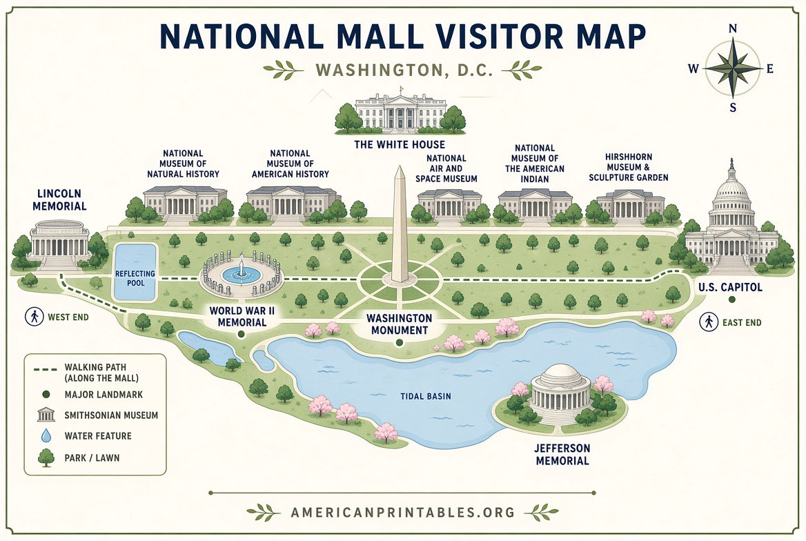
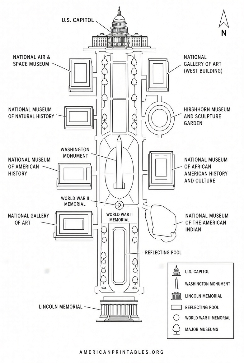
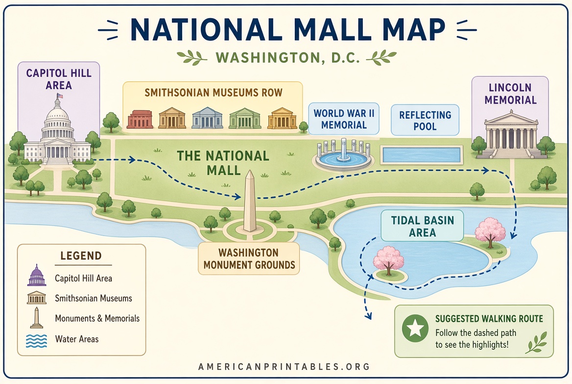
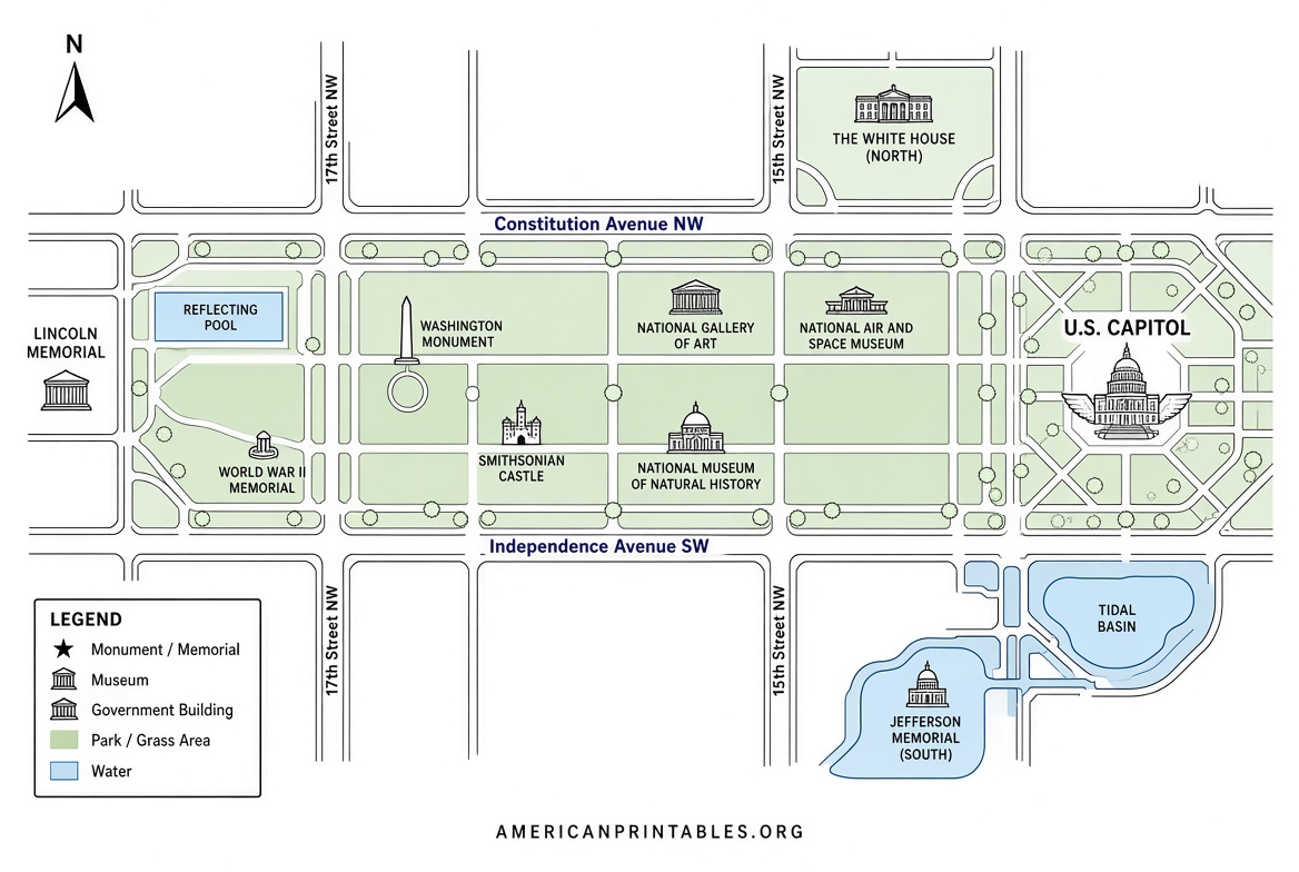
Free Printable National Mall Map PDF Guide – Planning a visit to Washington, D.C.? A clear, printable National Mall map helps you navigate the monuments, memorials, museums, and open spaces that make up America’s Front Yard. The National Mall stretches roughly two miles from the U.S. Capitol to the Lincoln Memorial and includes iconic sites like the Washington Monument, World War II Memorial, Vietnam Veterans Memorial, and many Smithsonian museums.
A free PDF printable National Mall map is one of the most practical tools you can bring. It works offline, folds easily into a pocket or bag, and lets you mark routes or points of interest without relying on cell service.
Why Use a Printable National Mall Map?
The National Mall is large and can feel overwhelming on a first visit. Paths, reflecting pools, and clusters of memorials are spread out. A paper map shows the overall layout at a glance, helps with walking distances, and highlights nearby Metro stations, restrooms, and visitor services. Digital apps are useful, but a printed PDF remains reliable when battery or signal runs low.
Official National Park Service (NPS) maps are the most accurate and up-to-date sources. They are produced by the federal government and are free for personal use.
Where to Download Free Legitimate PDFs?
Here are the most trusted places to get a free printable National Mall map:
- NPMaps collection of NPS brochure maps — This site hosts high-quality scans and restorations of official National Park Service maps. Download the main National Mall map (showing sites and attractions across the Mall and surrounding D.C.) or the 3D version that highlights key buildings and memorials in perspective. Both are free PDF downloads based on official NPS materials: https://npmaps.com/national-mall/ (look for the direct PDF links on the page for the brochure map and 3D map).
- Official National Park Service Maps page — Visit the National Mall and Memorial Parks maps section for current interactive tools, including accessible parking and bike rack locations. These complement a printable overview map: https://www.nps.gov/nama/planyourvisit/maps.htm.
- NPS Cartography catalog — Search the official National Park Service map library for free JPEG and PDF files produced by Harpers Ferry Center. Many brochure-style maps for the National Mall area are available for download and printing: https://www.nps.gov/subjects/gisandmapping/nps-maps.htm.
- National Mall Coalition free visitor map — This nonprofit offers a popular “National Mall: Stage For Our Democracy” map and historical guide that shows monuments, museums, transit, restrooms, and food options. Free printed copies are available at partner locations (including airport TravelersAid desks) or by request: https://www.nationalmallcoalition.org/2023/01/mall-maps/.
Stick to these authoritative sources. Avoid random third-party sites that may offer outdated, low-resolution, or non-official versions.
Free Printable National Mall Map PDF Guide
How to Print and Use Your Map Effectively?
Download the PDF and open it in a free reader such as Adobe Acrobat or your browser’s built-in viewer. For best results:
- Print on letter-size (8.5 × 11 inch) paper in landscape orientation if the map is wide.
- Use color if possible so landmarks stand out; black-and-white still works well for navigation.
- Scale to fit the page or print at 100% and trim if needed. Larger wall-style prints can be taken to a local print shop.
- Fold it accordion-style or place it in a clear plastic sleeve for weather protection.
Once printed, mark your starting point (many visitors begin near the Smithsonian Metro station or the Capitol end). Note walking times—distances between major memorials are longer than they appear. Pair the paper map with the free National Mall App from the NPS for real-time location and augmented-reality labels when you have signal.
Practical Tips for Visiting the National Mall
Wear comfortable shoes; the Mall involves a lot of walking on paved paths and grass. Bring water, sunscreen, and a light layer—weather changes quickly. Most memorials and outdoor spaces are free and open daily, though some museums require timed tickets. Check the official NPS site for current alerts, temporary closures, or special events before you go. Public restrooms and water fountains are available near major sites; food options range from food trucks to museum cafés.
Metro is the easiest way to arrive. Stations serving the Mall include Smithsonian, Federal Triangle, Archives-Navy Memorial, and L’Enfant Plaza.
Brief FAQ
Is the National Mall map free to print?
Yes. Official NPS maps and the NPMaps restorations of them are free for personal, non-commercial use.
Are these maps current?
NPS brochure maps and the agency’s online tools reflect the latest official information. Always cross-check the National Mall and Memorial Parks website for temporary changes.
Can I use the map on my phone instead?
Yes, but a printed PDF is recommended as a backup. Download the official National Mall App for interactive features.
Where else can I get a physical map on-site?
Visitor information areas and some partner locations (including certain airports and the National Mall Coalition partners) often have free printed maps.
A good printable National Mall map turns a potentially confusing walk into an organized, enjoyable day exploring some of the most meaningful places in the United States. Download one from a trusted source, print it, and enjoy your visit to the nation’s capital.